Data-Driven Bike Lane Strategy Could Ease Congestion in U.S. Cities
by Alli Romano
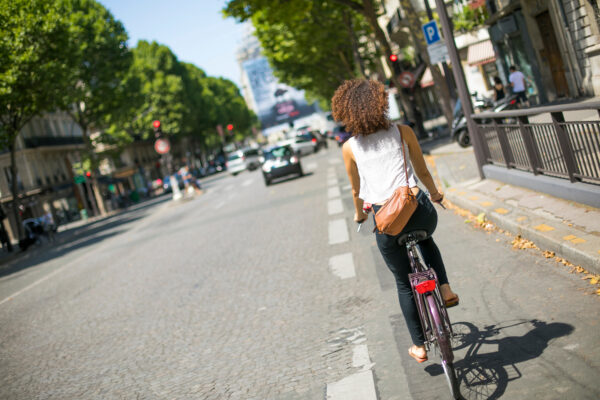
Expanding bike networks offers a promising solution to relieve traffic congestion and enhance urban sustainability in the U.S., said Jingwei Zhang, assistant professor of operations, technology, and information management at the Cornell SC Johnson College of Business.
In an article published online in December in the journal Management Science, Zhang and two coauthors said city planners can leverage data to strategically place bike lanes, creating benefits for both cyclists and drivers in any community. The team developed a model that offers city planners a toolbox to help effectively plan bike lane expansion and improve sustainability.
“Adding bike lanes encourages cycling and provides cyclists with safer routes and more extensive network, and drivers benefit from less congestion,” said Zhang, a sustainable operations researcher and faculty fellow at the Cornell Atkinson Center for Sustainability. “We’re providing a framework for optimal placement using existing data, which also enables prediction on the congestion on each road.”
After such additions, some drivers may adjust their routes or switch to cycling and public transportation, reducing congestion on streets with bike lanes, she said.
The article—“Planning Bike Lanes with Data: Ridership, Congestion, and Path Selection”—is the first to recommend optimal bike lane locations by taking a holistic view of a city’s road network, congestion, and commuting modes, noted Zhang.
Zhang and her co-authors, Sheng Liu of the University of Toronto and Auyon Siddiq of the University of California, Los Angeles, analyzed data in the entire road network during Chicago’s morning rush hour to identify where new bike lanes could have the most impact.
Their calculations determined that adding 25 miles of bike lanes in downtown Chicago would increase cycling ridership by nearly 70 percent, climbing to 6.1 percent from 3.6 percent.
Drivers would also benefit. Total travel times across all commuters would drop by 4 percent. While individual driving times may increase by up to 9.4 percent—about two extra minutes on a 20-minute commute—the shift to cycling reduces the number of cars on the road, easing overall congestion.
The model incorporates commuters’ choice of transportation (biking, driving, public transportation, or walking), commuting routes, and traffic congestion. It presumes that drivers strategically choose the fastest route from origin to destination, and it quantifies how expanding bike lanes affects cycling behavior and how shifts in transportation modes could relieve congestion.
The authors selected Chicago because although Chicago is tied with New York City for being the most traffic-congested city in the U.S., it is also bike-friendly, with 470 miles of bikeways and a flat topography well-suited to cycling. Plus, Chicago maintains a robust open data set, providing researchers with ample information.
Applying the Methods to Other Communities
This framework could help urban planners nationwide improve their decision-making on bike lanes and other infrastructure and transportation projects.
An avid cyclist, Zhang said many local officials plotting bike networks rely on simplified methods without considering traffic patterns and commuting data. Without accounting for these conditions, the bike lanes could be placed in unsuitable locations, potentially creating more congestion and safety concerns while also hampering sustainability efforts.
“Data allows planners to make more quantitative and scientific predictions,” she said. “By optimally designing bike lanes, a city can be more sustainable, safer, less congested in the most cost-effective way.”
The model is flexible and customizable, Zhang said. Other considerations such as political constraints, safety concerns, and even tourism goals—such as offering cyclists the best views—can be added based on a city’s unique circumstances.
“With data, we can prove or show that if there is one mile more, there will be an increase in cycling ridership,” she said. “If a planner comes to us for help, the answer will be yes.”
The researchers said the same framework can be applied to bus routes, carpool lanes, and other transportation systems to reduce congestion and improve safety.
Zhang applies her interests in optimization, game theory, and data-driven methods to public-sector planning and sustainable operations. She teaches machine learning in the Dyson School of Applied Economics and Management and often points to the bike lane research as an example of how quantitative analysis can support urban sustainability.
Next, she is developing a model to optimize bus and subway pricing and frequency based on the needs of different income groups.
“The magic of the data-driven method is that you can make decisions in a smarter, scientific, and informed way,” Zhang said.